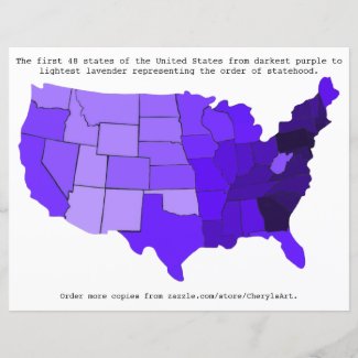
If you are looking for a visual representation for the order of statehood for the United States, you've come to the right place. I did a painting of a map of the United States in shades of purple. The darkest purple is the first state. As the other states gained statehood, the color for those states is lighter than the state that had gained statehood before it.
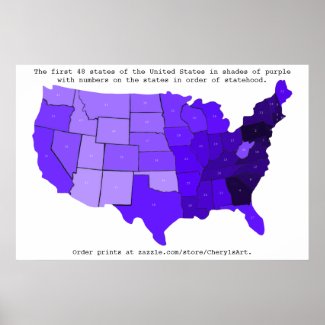
This first map is printed on posters. The darkest purple represents the first state, Delaware. The next lighter shade of purple represents the second state, Pennsylvania, and so on. All the way to the 48th state which is represented by the lightest shade of lavender. The corresponding number for the order of statehood is printed in white on each state.
I like how one can see the progression; it begins on the east coast with the purples and darker shades of lavender, gets around half way across the country, and then the medium lavender color jumps across to California before lighter shades of lavender start filling in the western half of the U. S.
How this project came about:
I was out shopping for wood plaques and I saw wooden maps of the United States. I just knew that I wanted to do something with that map, so I bought it. I looked forward to what I might create on it.
I considered a map of state birds or state flowers. But a lot of states didn't really have the room for such an endeavor.
However, the idea of flowers got me to thinking. I wondered what kind of flower the United States might look like if I painted each state a different shade according to the order of their statehood. I imagined perhaps that it might look like two carnations, one starting from each coast. Hmmm, sounded interesting.
What color should this "flower" be, I wondered.
Carnations comes in a variety of colors. The flag of the United States is red, white, and blue. Perhaps from red to pink, or dark blue to light blue. But I didn't want it to represent any one political party. Well red and blue make purple, and white will make each shade a bit lighter. Purple it shall be then, something that represents all parties.
As a fun and educational activity, students can write the number in on a smaller version of the map. I found that I started remembering more of the order with each activity that I did when creating this map.
Do you think this visual representation will help students learn more about the order of statehood? Let me know in the comments below.
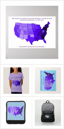
Check here for more Order of Statehood products:
Cheryl Paton
CherylsArt shares family friendly designs printed on tshirts, mugs, stationery, and more. Most of these products are from my CherylsArt store on Zazzle. https://www.zazzle.com/store/CherylsArt. Find my coloring books, scrapbook paper books, notebooks and more, on my author page on Amazon. https://www.amazon.com/author/cherylpaton.